See where trail cameras cannot

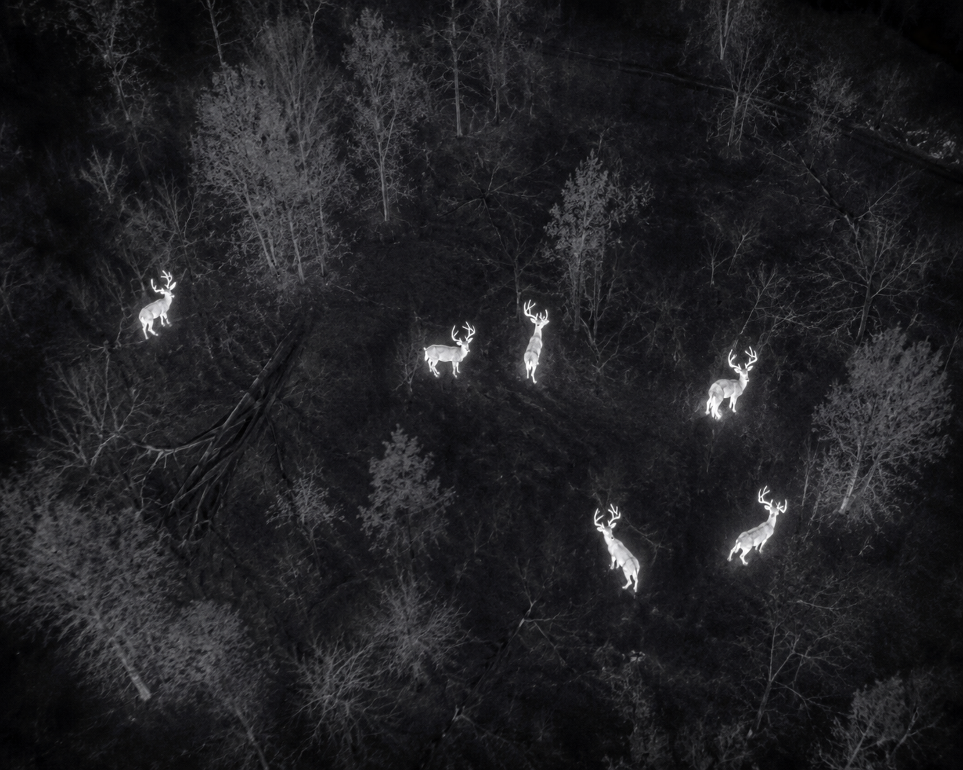
Aerial Deer Herd Analysis

Herd analysis is planned around acreage, terrain, access, season and survey goals. Results are observational and should be considered alongside normal wildlife-management practices.
Herd Analysis with Volunteer Drone Services

What to expect

A clear process built around the search.

Property-level thermal surveys that help landowners better understand deer presence and distribution.

01

Define the property

Share boundaries, acreage, access points and the questions you want the survey to address.

02

Plan the survey

VDS reviews terrain, airspace, timing and the flight plan needed for useful coverage.

03

Review the findings

Receive a practical summary of observed animals and areas of activity from the survey.

Service details

What this search includes

  • Property-level thermal survey
  • Pre-season planning support
  • Post-season herd evaluation
  • Acreage-based project
Call for a quote

Reach out to VDS for a quote based on search time and mileage.

Discuss a herd survey

Deer recovery field work

Deer stories and search footage.

View this archive

Velvet Buck Recovery

Velvet Giant

This impressive buck carries a large rack with long tines, all still covered in velvet. The close aerial footage captures the size and detail of his antlers, offering a clear look at a standout velvet buck.

Nighttime Deer Recovery

From Thermal Detection to Visual Confirmation

A nighttime thermal search identifies a deer near wooded cover. Switching to the zoom camera and spotlight provides a clear view of the buck, turning a distant heat signature into a confirmed location.

Woodland Deer Recovery

A Buck Hidden Beneath the Brush

A thermal signature draws attention to a buck partially concealed beneath evergreen branches. A closer aerial view reveals the deer among tangled vegetation and fallen leaves, illustrating the visibility challenges encountered during recovery searches.

Herd Analysis

Herd Analysis: Buck Observation

During a herd analysis flight, VDS captures a detailed aerial view of a buck and marks its location. Visual and thermal imagery help document the deer’s antler development, behavior, and presence on the property, giving landowners useful information about their local herd.

Thermal Deer Recovery

Pinpointing a Buck in a Wooded Opening

VDS follows a thermal signature to a buck lying in an opening between trees. The drone’s spotlight and zoom camera provide a detailed view before the camera returns to a wider perspective of the surrounding terrain.

Wildlife Encounters

An Albino Doe Encounter

An aerial search reveals an albino doe resting in wooded cover. After detecting its heat signature, VDS switches to the visual camera, capturing the doe’s distinctive white coat against the surrounding leaves and vegetation.